|
| *****SWAAG_ID***** | 193 |
| Date Entered | 17/05/2011 |
| Updated on | 17/05/2011 |
| Recorded by | Tim Laurie |
| Category | Vernacular Record |
| Record Type | General HER |
| Site Access | Army Range |
| Record Date | 16/05/2011 |
| Location | Throstle Gill, east bank. Army Range. Feldom Training Area. |
| Civil Parish | Marske |
| Brit. National Grid | |
| Altitude | NZ 086 031 |
| Geology | River terrace. |
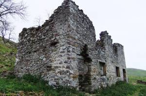
| Record Name | Throstle Gill. Pair of conjoined deserted cottages. |
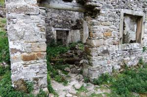
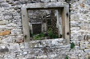
| Record Description | Two semi detached roofless and ruined two storey stone cottages. Each with surviving door and window. Part demolished, fireplaces and flues removed but stone window and
rebated linings to ground floor windows with shutter hinge survive. Windows originally mullioned, mullions removed. Rooms plastered. Entrance doors to rear scullery/stores/stairs survive, see photos. |
| Dimensions | Not surveyed. |
| Additional Notes | These cottages are a marvellous survival from a bygone era, from the time when Telfit was populated and before HM Government purchased (See Note) the Feldom Estate from the Hutton family in 1940 for the amazing sum of �3,126,045.00 (a fortune at that time for 2507.5 acres of pastur land mostly above 300m!.
One wonders what price was agreed for these two cottages as part of the deal.
Note
For details of the history and development and subsequent purchase by the War Dept of Cordilleras Farm, see: 'Cordilleras Farm. A History' by Lt Col. H. S.Le Mesurier.In: 'West Feldom'. Catterick and Feldom Conservation Group Monograph.Ed.Col.P.W.Wade. |
| Image 1 ID | 660 Click image to enlarge |
| Image 1 Description | Throstle Gill. The two cottages. |  |
| Image 2 ID | 661 Click image to enlarge |
| Image 2 Description | The cottages. Detail. |  |
| Image 3 ID | 662 Click image to enlarge |
| Image 3 Description | The cottages. Detail. |  |


